When the American Revolution ended in 1783, the new United States faced a problem it had no money to solve.
The soldiers, officers, and veterans who had fought for American independence had been promised compensation for their service. Many had served for years under brutal conditions, endured harsh winters, survived wounds and disease, and watched friends and comrades die on fields from Massachusetts to Georgia. The Continental Congress had made promises to these men. Now it had to keep them.
The federal treasury was empty. But there was one thing the new nation had in abundance. Land.
A Debt Paid in Acres
The solution was the military land warrant system. Veterans of the Continental Army and state militias were issued warrants entitling them to specific acreages of public land in compensation for their service. The longer and more distinguished the service, the larger the warrant. A private might receive 100 acres. A general might receive several thousand.
Virginia took this system further than most states. The Commonwealth of Virginia had maintained its own military forces throughout the Revolution and had made its own promises to its own veterans. To fulfill those promises Virginia negotiated a remarkable arrangement with the federal government. A specific tract of land in the newly organized Northwest Territory would be set aside exclusively for Virginia’s veterans. That tract became known as the Virginia Military District.
The Virginia Military District encompasses a broad swath of south-central Ohio covering parts of what are now more than two dozen counties. It is bounded roughly by the Scioto River to the west, the Ohio River to the south, and the Congress Lands to the north and east. Within this district Virginia retained the right to survey and distribute land to its veterans under its own system, independent of the federal rectangular survey system that governed most of the rest of Ohio.
That independence would have profound consequences for the landscape of the district for generations to come.
The Warrant System
A Virginia Military warrant was a legal document entitling its holder to claim a specific number of acres within the Virginia Military District. Warrants were issued in the name of the veteran who earned them, but they were freely transferable. A veteran could sell his warrant, give it away, or pass it to his heirs. This transferability turned military warrants into a form of currency on the early American frontier.
Land speculators understood this immediately. Warrants could be purchased from veterans who needed cash more than they needed Ohio land, assembled into large holdings, and then converted into surveyed tracts that could be sold at a profit. Some of the largest early landholdings in the Virginia Military District were assembled this way, by men who never served a day in the Continental Army but who understood the value of land in a rapidly expanding nation.
This meant that the holder of a Virginia Military warrant was not always the veteran who earned it. Sometimes it was a son or daughter who inherited it. Sometimes it was a land agent who purchased it for speculation. Sometimes it was a business partner or a creditor who received it in settlement of a debt. Tracing the history of a Virginia Military District tract often means tracing a warrant through multiple hands before it reaches the man who actually put a plow to the soil.
The Surveys
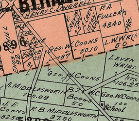
Surveying in the Virginia Military District was a different proposition than surveying in the rest of Ohio. The federal rectangular survey system that governs most of the country uses a precise grid of townships and ranges, producing the characteristic square fields and straight roads that define the Midwest landscape. The Virginia Military District used a different system, one inherited from Virginia’s colonial surveying tradition.
Virginia Military District surveys were metes and bounds surveys. Rather than fitting into a pre-established grid, each survey began at a specific landmark, a tree, a stone, a stream confluence, and described the boundaries of the tract by compass bearing and distance, moving from landmark to landmark until the survey returned to its starting point. The result was a landscape of irregular, overlapping, and sometimes contradictory surveys that has produced property boundary disputes in central Ohio for two centuries.
The surveyors who carried out this work operated on the edge of the American frontier. They worked in dense forest, crossed swollen streams, located corners in landscapes with no permanent markers, and produced documents that would govern property rights for generations. It was skilled, difficult, and consequential work.
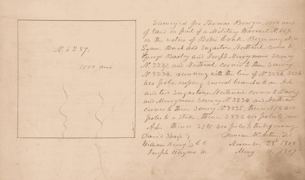
Among the most notable of these surveyors was Duncan McArthur, a Scottish-born frontiersman who surveyed Virginia Military District tracts in the years following 1799. McArthur would go on to serve as a general in the War of 1812 and eventually as Governor of Ohio. In 1808 and 1809 he surveyed Virginia Military Survey No. 5289 in what would become Union County, a tract that would eventually become the site of one of the earliest settlements in York Township.
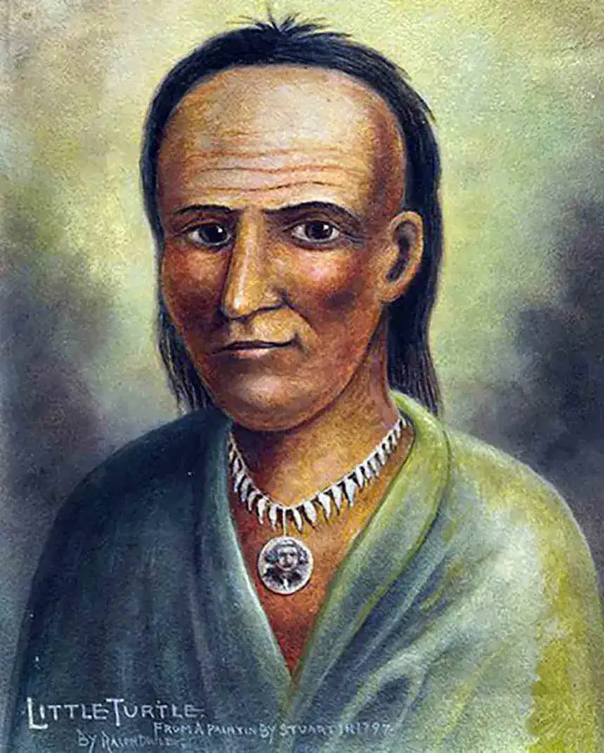
The Veterans
Behind every Virginia Military warrant was a story of service. Some warrants were issued to men who fought at Valley Forge, at Brandywine, at Yorktown. Some were issued to militia members who served shorter terms in the defense of Virginia’s frontier settlements. Some were issued to officers who commanded regiments and some to privates who carried a musket through years of campaigns.
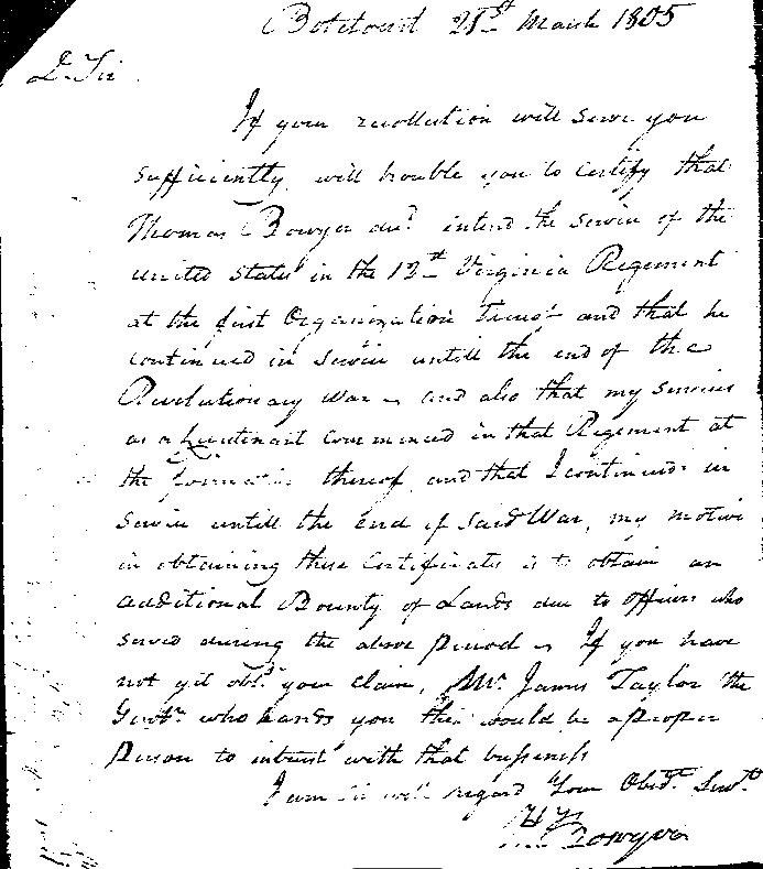
Thomas Bowyer was one of these men. He served in the 12th Virginia Regiment from 1776 through the end of the Revolutionary War, earning the warrant that would eventually be used to survey the land in Union County that bears his name in the county’s deed records to this day. The letters of his fellow officer Henry Bowyer, preserved in the Virginia state archives, confirm their service and their efforts to claim the bounty land they were owed.
Most of these men never saw the Ohio land their service had earned them. The warrant system allowed them to sell or transfer their claims, and many did exactly that, taking cash in hand rather than making the long journey west to an uncertain frontier. The men who actually settled the Virginia Military District were often a generation removed from the Revolution itself, farmers and families who purchased warrants from veterans or their heirs and came west looking for land and opportunity.
But the connection to the Revolution was real. Every farm in the Virginia Military District, every cabin built on a surveyed warrant tract, every township organized on land that had been allocated to a Continental Army veteran, was in some sense a product of the Revolutionary War. The Ohio frontier and the American founding were not separate chapters. They were the same story told across a generation.
The Legacy
The Virginia Military District today is most visible in the irregular property boundaries and winding roads that distinguish south-central Ohio from the grid-organized landscape of the rest of the state. Where most of Ohio was surveyed into neat townships and sections, the Virginia Military District follows the curves of the land, the courses of streams, and the compass bearings of surveyors who worked tree by tree through the wilderness more than two centuries ago.
Those boundaries are still generating legal questions today. The overlapping and sometimes contradictory nature of metes and bounds surveys has produced title disputes, boundary uncertainties, and surveying challenges that persist in central Ohio courthouses long after the last veteran of the Continental Army has been gone for nearly two centuries.
But the district’s legacy is more than a surveying puzzle. It is a direct, physical connection between the American Revolution and the Ohio landscape. Every time a deed in the Virginia Military District references a warrant number, every time a property description begins at a corner tree that was marked by a surveyor in 1802 or 1808 or 1815, the link to the men who fought for American independence is still present in the land itself.
That is the kind of history the Ohio Frontier History Center exists to find, to document, and to tell. It is not history that announces itself. It is history that requires patience, research, and a willingness to read the landscape carefully. But it is there, written in deed books and survey records and warrant registers, waiting for someone to bring it back to the surface.